
Field Record Book: map, master data and history in one place
Vinitor brings all your vineyards together in one place — each one as an area on the satellite map, with grape variety, master data and a complete history. Create them in the four-step wizard, bring them in via import from the authority portal, maintain them through bulk editing in the table. The digital field record book is the heart of Vinitor — and permanently free.
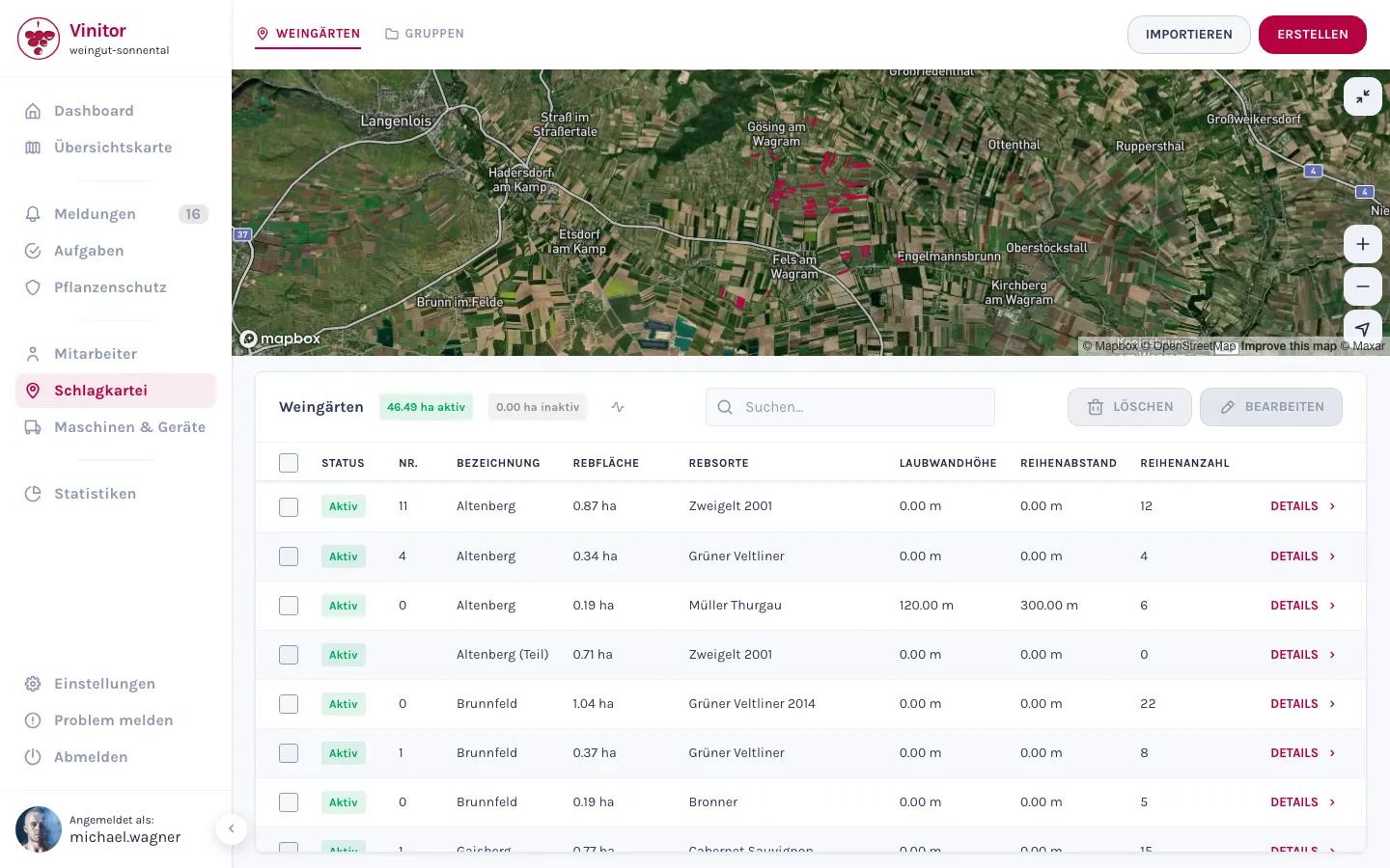
Every vineyard on the map — the master data right beside it
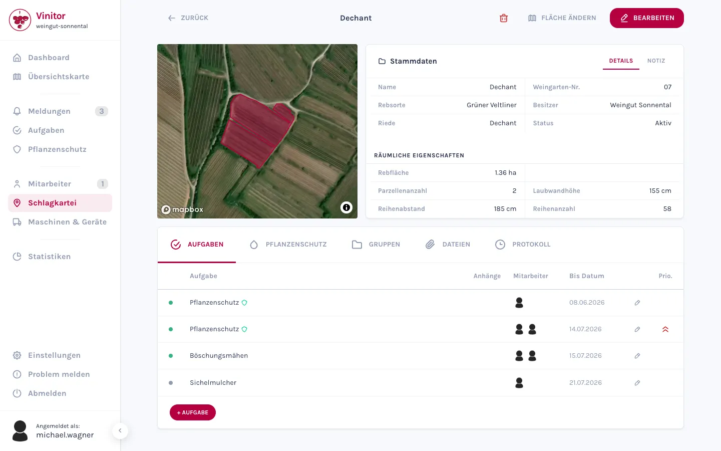
Vinitor brings all your vineyards together in one place. The satellite map at the top shows every vineyard as an area, with the table of vine area, grape variety and the remaining master data below. Open a vineyard, and the map, master data and complete log sit side by side. You maintain the leaf wall height and row spacing at the same time — they later feed into the plant protection calculation.
- Satellite map with all vineyard areas — one click on an area selects the vineyard.
- Master data per vineyard: grape variety, named vineyard site, owner, parcels, leaf wall height and row spacing.
- Table searchable and sortable — by name, vine area, grape variety, row spacing and more.
- Active and inactive vine area always in view as a hectare total.
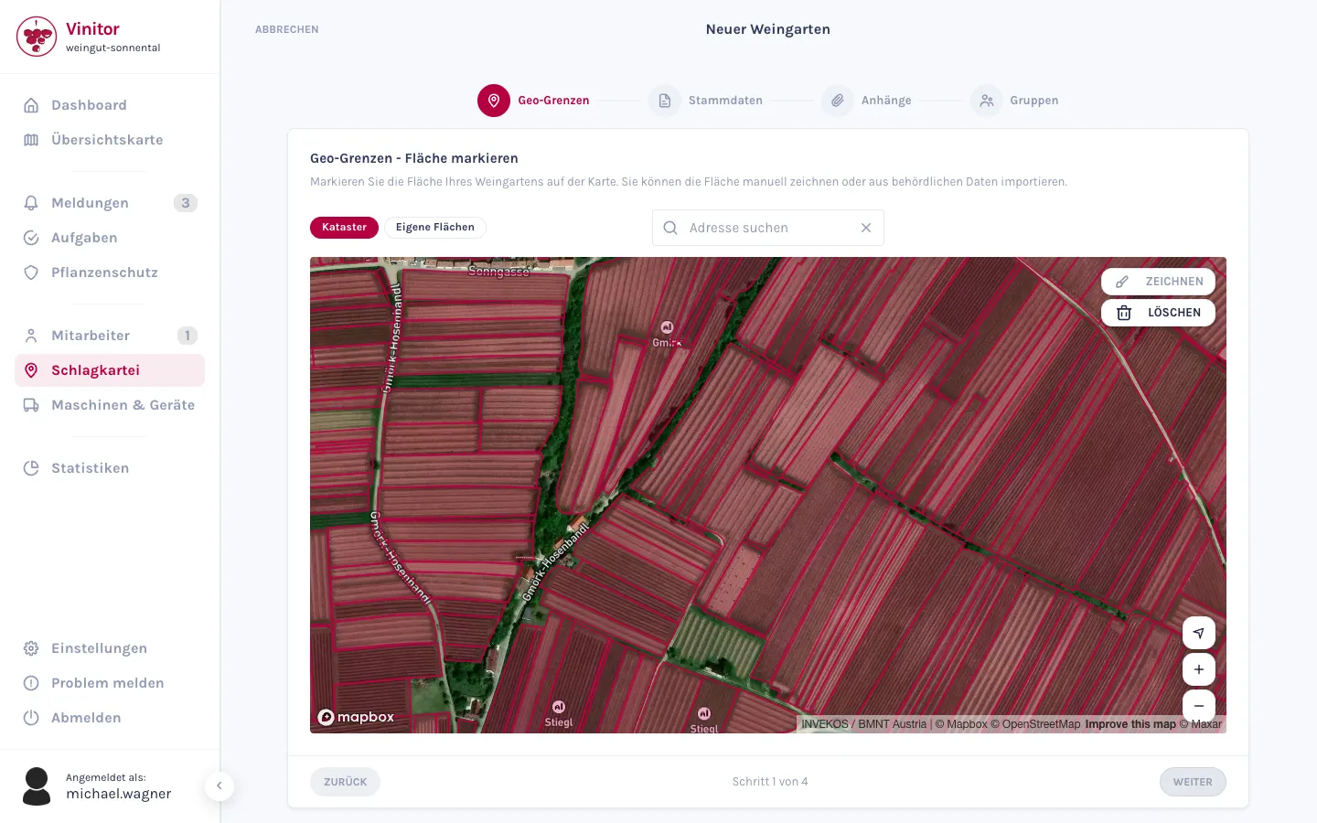
A new vineyard in four steps
A new vineyard is created in a four-step wizard. You first draw the boundaries on the map — manually or using official geometries as a template — and Vinitor calculates the area in hectares as you draw. Only once the boundaries are set does it move on to master data, attachments and groups.
- Four steps: geo-boundaries, master data, attachments, groups.
- Draw the area — Vinitor calculates the hectares live as you draw, no measuring required afterwards.
- The calculated area is automatically applied as the vine area; you enter the land registry area separately.
- Vineyards may not overlap — Vinitor checks this when you save.
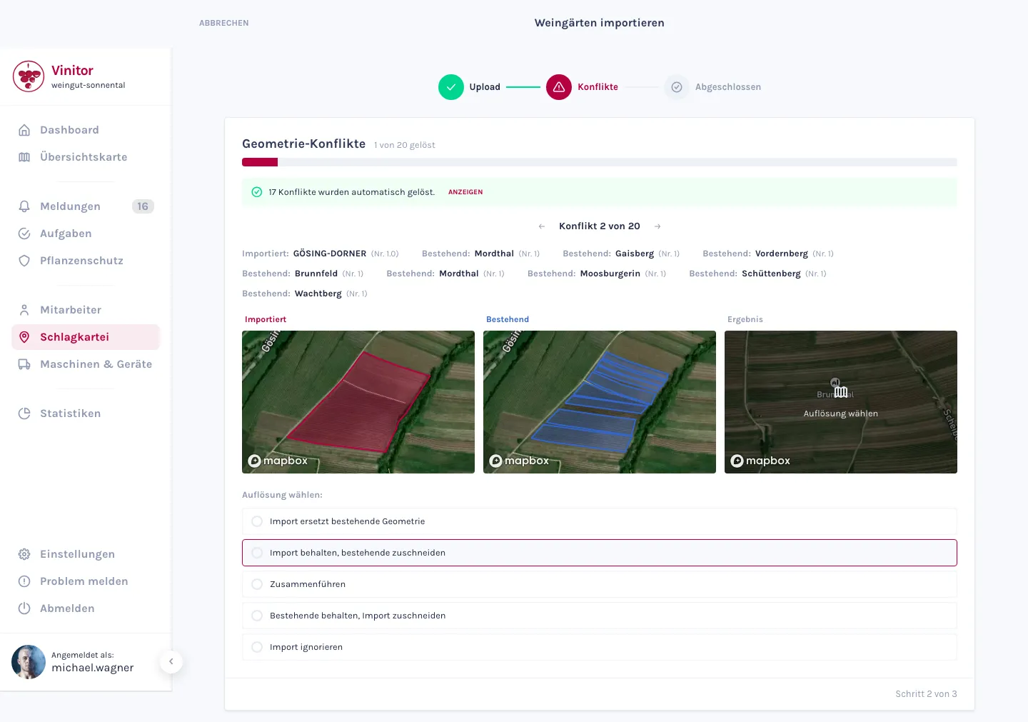
Import from the authority portal — or draw with official geometries
Are your vineyards already digital at the authority portal? Then you simply upload them. Vinitor reads the shape files from the ZIP and creates each vineyard with its area and master data. If an imported area overlaps with an existing one, you decide in a direct comparison which geometry applies.
- Import from eAMA (Austria), FIONA (Baden-Württemberg), LAFIS (South Tyrol), LEA (Rhineland-Palatinate) and LAWIS+ (Switzerland).
- Resolve conflicts in a three-map comparison — Imported, Existing and Result side by side.
- Vinitor resolves clear-cut overlaps automatically; you decide the rest area by area.
- Two options on import: overwrite attributes, and deactivate vineyards not included.
If you'd rather create one by hand, you still don't have to guess: in the area editor, you overlay official parcels as a template — live from the authorities' services. You take over the matching area and only need to correct the boundaries.
- Official geometries as a template: INVEKOS (AT), Rebbaukataster (CH), Baden-Württemberg (DE), South Tyrol and LPIS (CZ).
- The parcels come straight from the authorities' services, live, into the area editor.
- From the selection, Vinitor takes over the name, named vineyard site and area — you only need to correct the boundaries.
Form groups — and optimise the route
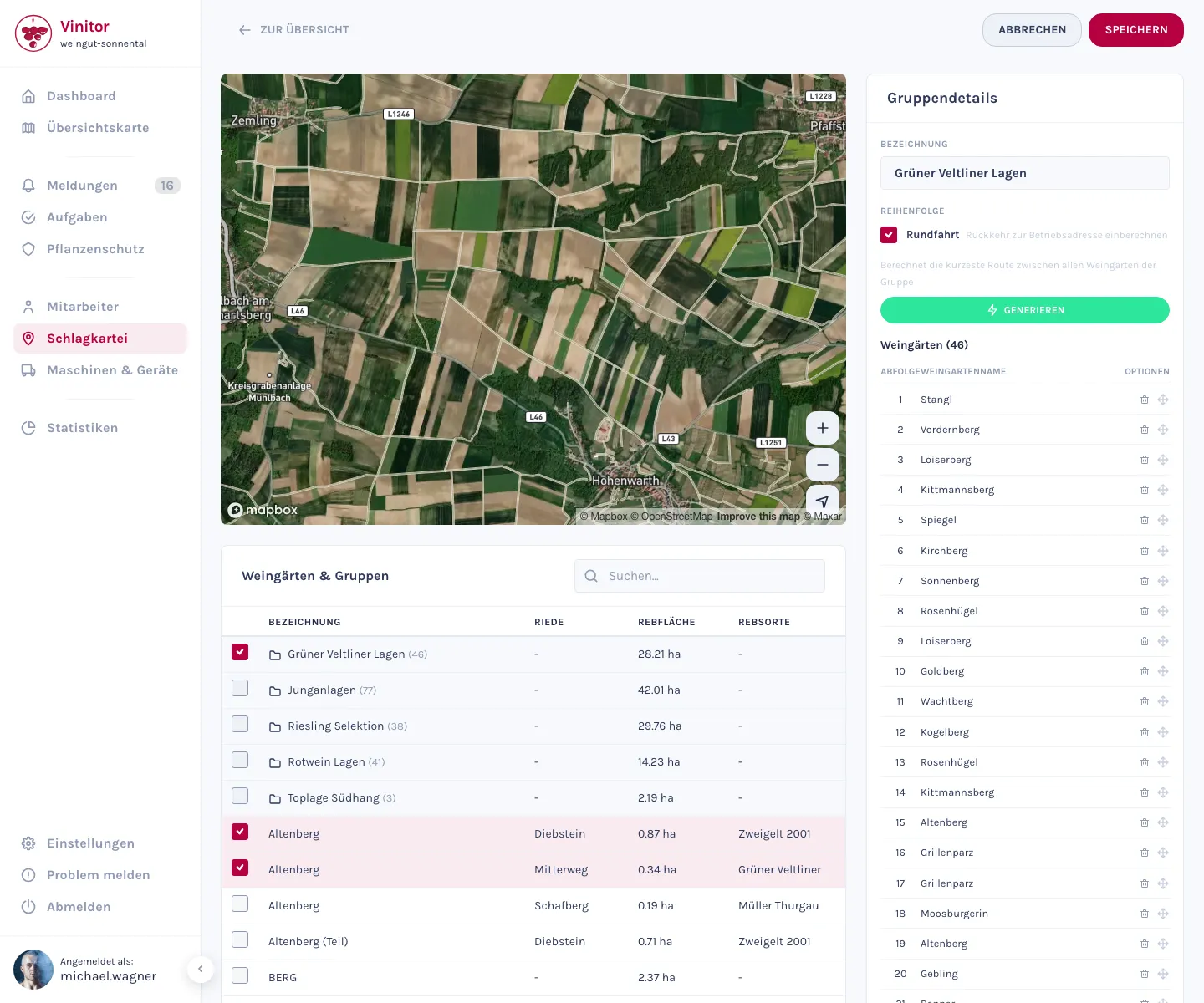
Group vineyards together — by location, grape variety, or however you plan your work. In the group area, you put together the members, put them in order and let Vinitor optimise the route: the shortest possible round trip through all the vineyards in a group, calculated from your business location. Every group shows you the vine area and grape varieties at a glance.
- Groups by location or grape variety — with a vine area total and grape variety breakdown per group.
- Route optimisation: the shortest possible round trip through the vineyards in a group, starting from your business location.
- Adjust the order of vineyards via drag & drop — optionally as a round trip back to the start.
- Merge several groups into a new one with one click.
Maintain, trace, file
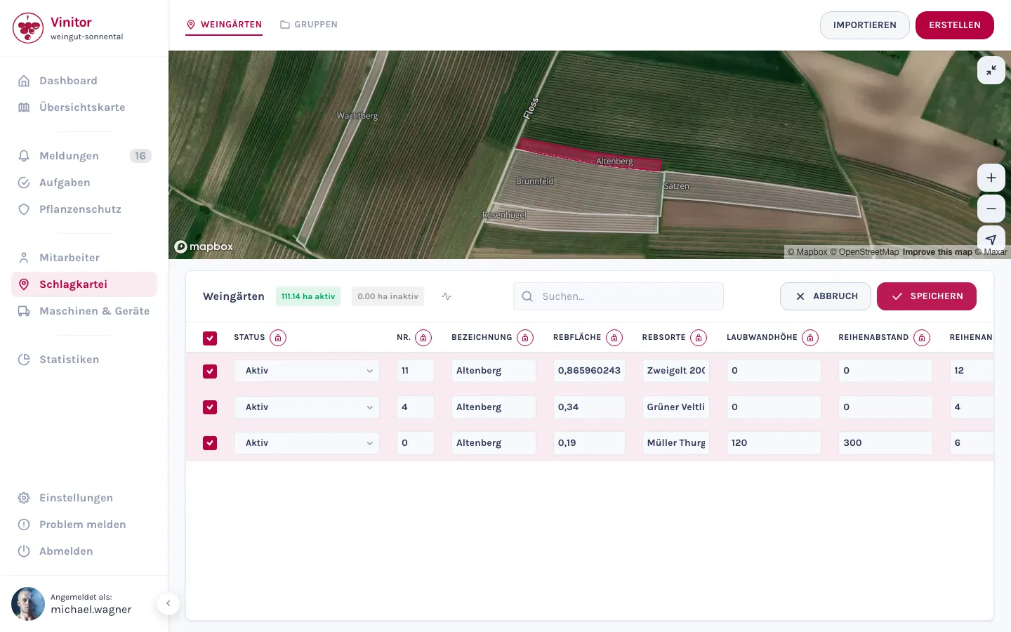
Everyday life runs on small stuff — and Vinitor takes that off your hands. Change many vineyards in one go, directly in the table, file documents against each vineyard, and check the log to see who changed what and when. And the area trend shows you, as a chart, how your vine area has grown over the years.
- Bulk editing: change several vineyards at once in the table — lock a column and apply the value to all selected rows.
- Log per vineyard: creation, area and attribute changes (with before/after), files and groups — with timestamp and person.
- Files & attachments per vineyard — upload via drag & drop, download at any time.
- Area trend as a chart: active and inactive vine area over time.
Frequently asked questions
Which systems can I import from?
Where do the official geometries come from?
Is the area calculated automatically?
Does the app work offline?
What does it cost?
Nothing — that's part of the free tier: free forever, for any size of business, no credit card and no expiry date. What the add-on modules cost is shown on the pricing page.
The easiest thing is to just try it.
The free tier stays free — add modules when you need them.
Even more detail — field tables, permissions, step-by-step guides — is in the documentation:Field Record Book in the documentation →